Faisal Hills is located on the N-5 Grand Trunk Road near Taxila, in Rawalpindi District. It falls within Zone 2 of Islamabad’s planning area and sits at the western foothills of the Margalla Hills between Islamabad to the east and Taxila to the west.
This boundary position gives residents Islamabad proximity without inner-city congestion or inner-city pricing.
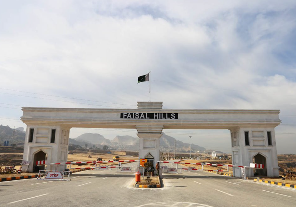
GT Road (N-5) Core Infrastructure Asset
The N-5 Grand Trunk Road is one of Pakistan’s most strategically important national highways, running from Peshawar through Rawalpindi, past Taxila, and onward to Lahore. Faisal Hills has direct frontage on this road via two main society entrances.
GT Road frontage cannot be acquired after the fact it is a permanent connectivity asset that benefits every block in the society.
Who Benefits Most from GT Road Access
- Residents: Direct access to Taxila, Wah Cantt, Rawalpindi, and Islamabad without entering city-center traffic.
- Commercial investors: Built-in daily traffic exposure for Executive Block and Hill Walk Downtown commercial units.
- Commuters: Public buses and wagons run between Rawalpindi Saddar and Taxila along the GT Road daily.
M-1 Motorway Islamabad Access Without City Traffic
Current Connectivity
The Peshawar–Islamabad M-1 Motorway is accessible from Faisal Hills in approximately 22 minutes. It is a signal-free, dual-carriageway highway. Islamabad International Airport is ~25 km away via this route, with a travel time of 20–25 minutes under normal conditions.
Block C’s M-1 Advantage
Block C is positioned closest to the M-1 within the Faisal Hills master plan. A planned interchange directly connecting Block C to the M-1 will materially reduce travel time to the motorway network once operational.
M-2 Motorway – Block D’s Key Differentiator
Current Proximity
The M-2 Motorway (Islamabad–Lahore) is accessible from Faisal Hills in approximately 25 minutes. Block D sits closest to this motorway within the society’s boundaries.RDA oversees planned interchange approvals in this zone.
Planned M-2 Interchange
A dedicated interchange connecting Block D to the M-2 is in the planning stage. When operational, it will give Block D residents near-direct motorway access to Lahore without passing through Rawalpindi city traffic.
CPEC Route The Strategic Long-Term Play
What CPEC Means for GT Road Properties
The China–Pakistan Economic Corridor (CPEC) runs through the N-5 GT Road corridor — the same road Faisal Hills sits on. CPEC has already brought industrial development, infrastructure investment, and economic activity to the Taxila–Wah–Islamabad corridor.
Faisal Hills is not near the CPEC route. It is on it. That is a structural long-term advantage independent of any single project or government announcement.
Block C and the Future CPEC Connection
Block C has a planned link connecting it more directly to the CPEC route via the M-1 Motorway. This is a 3–5 year play. Entry price in Block C today reflects an early position on a corridor that is gaining measurable economic significance.
Margalla Avenue the Commute Game-Changer
Before Margalla Avenue, the daily commute from Faisal Hills to central Islamabad was a practical barrier for most families. That has changed.
Via Margalla Avenue, Faisal Hills is now 23–37 minutes from central Islamabad — competitive with many societies that sit geographically closer to the capital. The result has been a sustained rise in end-user demand from families intending to actually live there, not purely speculate on file values.
Distance Reference Faisal Hills to Key Destinations
Use this table to evaluate commute practicality before choosing a block.
| Destination | Distance | Travel Time |
| Taxila City | ~5 km | 5–10 min |
| B-17 MPCHS | ~4 km | 5 min |
| Wah Cantt | ~10 km | 10–15 min |
| HITEC University Taxila | ~8 km | 10–12 min |
| M-1 Motorway | ~18 km | 22 min |
| Islamabad International Airport | ~25 km | 20–25 min |
| M-2 Motorway | ~20 km | 25 min |
| Islamabad Blue Area | ~35 km | 30–45 min |
| Rawalpindi Saddar | ~30 km | 35–40 min |
Why Location Drives Block Prices – Summary
Each block’s price reflects its specific location advantage within the society.
| Block | Location Advantage | Price Driver |
| Executive Block | GT Road frontage, main entrance | Commercial visibility + max connectivity |
| Block A | Developed boulevard, Hill Walk proximity | Mature infrastructure + lifestyle assets |
| Block B | Margalla Hills views, quiet residential | Lifestyle premium, park-facing plots |
| Prime Block | Near Taxila Chowk, Gate 2 entrance | New underground infra at launch pricing |
| Block C | Closest to M-1 Motorway + CPEC link | Pre-interchange entry pricing |
| Block D | Closest to M-2 Motorway | Post-possession + planned interchange |
| Block B Ext. | Hilly terrain, strongest hill views | Earlier-stage, highest view premium |
Frequently Asked Questions
How far is Faisal Hills from Islamabad International Airport?
Approximately 25 km via M-1 Motorway and GT Road. Travel time is 20–25 minutes under normal traffic — mostly signal-free driving on the motorway and national highway.
Is Faisal Hills on the CPEC route?
Yes. The N-5 GT Road, on which Faisal Hills has direct frontage, is part of the China–Pakistan Economic Corridor infrastructure. Block C also has a planned additional connection to the CPEC route via the M-1 Motorway.
Which block has the best motorway access?
Block D sits closest to the M-2 Motorway and has a planned interchange in development. Block C is positioned closest to the M-1 Motorway connection. Both blocks carry above-average long-term price catalysts tied to motorway access improvements. All planned infrastructure developments in this zone fall under the jurisdiction of the Rawalpindi Development Authority (RDA) — buyers can verify interchange approval status directly at rda.gop.pk.
Is Faisal Hills in Islamabad or Rawalpindi?
Administratively it is in Rawalpindi District near Taxila. However, it falls within Zone 2 of Islamabad’s planning area. Both cities are accessible within 30–40 minutes.
What is the best route from Islamabad to Faisal Hills?
Via Margalla Avenue (F/E sectors): ~30 km, 23–37 min. Via GT Road from Rawalpindi Saddar: 35–40 min. Via M-1 from the airport: 20–25 min — the smoothest airport-to-home route.
Conclusion
Faisal Hills sits on one of the most infrastructure-rich corridors in the Twin Cities region. GT Road frontage is immediate and permanent. M-1 and M-2 access is already practical. CPEC proximity is structural. Margalla Avenue connectivity has already shifted the commute dynamic.
The planned interchange developments for Block C and Block D are the next wave of location-driven price catalysts. For buyers who understand that location value compounds over time, Faisal Hills presents a case that is significantly stronger than its current pricing suggests.
